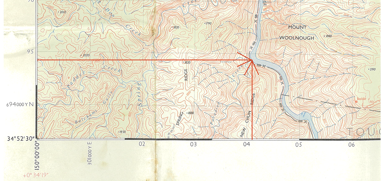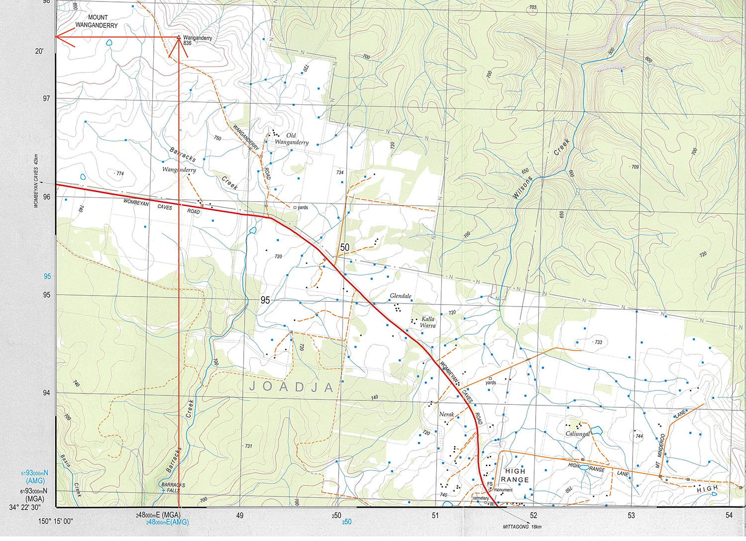
Plotting a grid reference on a map is the reverse process of reading it on the map.
Example 1: Plotting the grid reference ‘Caoura AMG-041948’, the junction of a creek with a major river.
The reference 041948 is a six-digit grid reference with a 041 Easting and 948 Northing. Find the 04 Easting line and follow it 1/10th of the way further east. Then find the 94 Northing line, and follow it 8/10th of the way further north. The grid point is the junction of Paradise Creek with the ShoalHaven.

Example 2: Plotting the grid reference for Mt Wangandarry ‘Hilltop MGA-48259765’, a trig point.
The reference 48259765 is an eight-digit grid reference with a 4825 Easting and 9765 Northing. Find the 48 Easting line and follow it 25/100th of the way further east. Then find the 97 Northing line, and follow it 65/100th of the way further north. The grid point is the top of a knoll on a large flat hill top.

Tools
Coordinate plotting tools can aid plotting grid points on maps. Grid tools enable the user to keep an exact right-angle position as they find the coordinates they’re looking for, and the user does not need to draw lines on the maps.
A UTM plotting grid is one option. Alternatively, a corner style tool or simple ruler. Ensure that any map plotting tool has the right scale (note that American sellers stock 1:24,000 tools, not to be confused with the more common 1:25,000 series used in Australia).