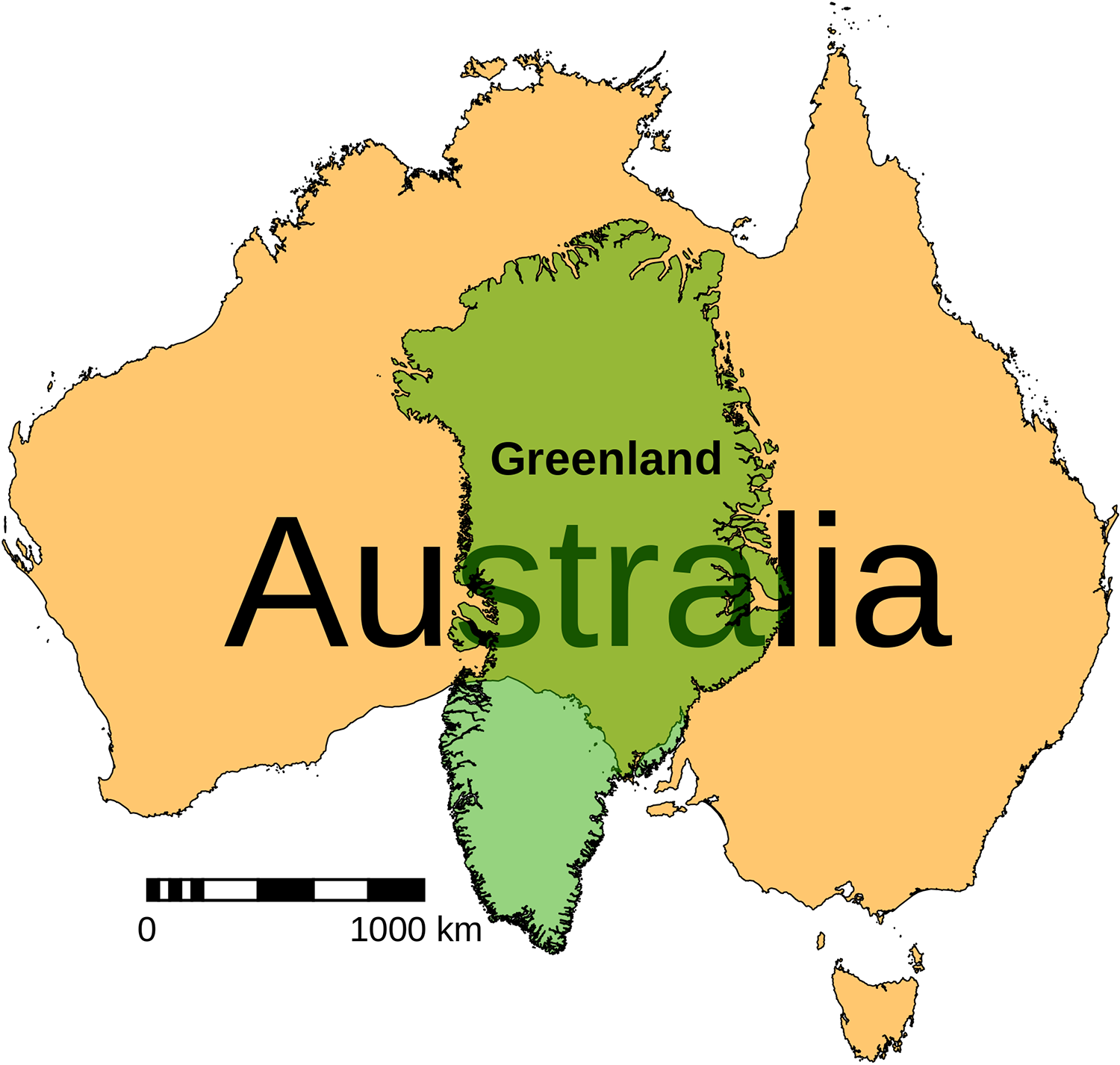
All mapmakers have to overcome the fundamental mathematical problem of portraying a spherical object onto a 2D surface. Modern map-makers solve this by taking a ‘datum’, that is, a 3-D representation of the earth, and projecting it onto a 2D plane (i.e. Cartesian x-y coordinates).
This image is the typical one of the Earth centred around Europe. It is produced by converting the curved, spherical lines of longitude and latitude into a flat plane grid of perpendicular lines, but it is severely distorted at the poles.
That’s why although Greenland appears almost same size as Australia on the world map, it’s only a third of the size.
No model or projection is perfect for every part of the globe, and different countries preference some projections over others to suit their needs.
In Australia, the modern MGA reference system uses the Universal Transverse Mercator projection of the Geocentric Datum of Australia 1994 (GDA94), providing a relatively universal reference system at least for the purpose of recreational bushwalking.

